Bachelor Party II: Backpacking in the Wind River Range
...or wet and wild in the Wyoming wilderness...
Read Mike's report
 August 14-19, 2004
 Last year I treated my pal Mike to a 9-day backpacking extravaganza in lieu of a bachelor party in which we completed most of the Appalachian Trail through Pennsylvania. Of course, in the process he suffered some incredible blisters and a hernia. With my approaching nuptuals, he decided to return the favor and take me out for a week of abuse in Wyoming's rugged, beautiful Wind River Range. Joining us was intrepid hiker and fellow groomsman Tom Kornack. The plan was to spend six nights completing a roughly 50-mile circuit hike in the Winds hitting the famous Cirque of the Towers along the way and doing various side trips into interesting-looking terrain.
 I have to admit, I was a bit nervous about this hike. Mike and Tom are both stronger hikers than I but I was hoping that my acclimatization to altitude would give me a leg-up on them. Furthermore, Mike is an expert in birds and both of them are serious wild-flower afficionados and photographers. That should slow them down a bit!
Saturday, August 14 Mike had flown in the evening before and we'd spent the night packing, repacking and agonizing over gear choices. We set out from Boulder in the sunny morning hours to pick up Tom at the Denver Airport and head north. Tom arrived with no troubles along with a monstrous backpack laden with enough food for all three of us (he was only actually responsible for a third of it but is notorious for bringing vast quantities of yummy food) and about six pounds of camera gear. The six hours of driving north on paved roads went well enough and we arrived in the hamlet of Farson at 6:30 pm without a problem.
From Farson, the going gets interesting to say the least. Wyoming is a very big, and very under-populated state. To get to the Big Sandy Trailhead, you must drive 40 miles on dirt roads through endless, rolling sagebrush prairie. I generally love driving dirt, particularly in our Subaru, but 40 miles is a long way. Still, the roads are reasonably well marked and in pretty good condition, navigable by any sort of car and we arrived at the ample and crowded trailhead by 8pm and at 9000 feet elevation.
Light was waning and we set out to put a mile or two of trail under our heels before setting up camp. After a quarter mile, we found a large meadow and camped around the bend, out of sight from the trail. Mike instructed us as to the care and feeding of his huge 3-person tent and I set up the bear bag.
Sunday, August 15 We arose early and set out up the trail by 8am. Some early-morning map consultation had decided us to camp at the nearby Big Sandy Lake (5 miles) and then spend the rest of the day exploring some of the valleys and lakes on this (the west) side of the Continental Divide rather than pushing directly over the Divide to the Cirque of the Towers. The trail to the Lake was gentle and short and we arrived, somewhat surprised, before 11am.
 Camp I: a quarter mile from the car. |
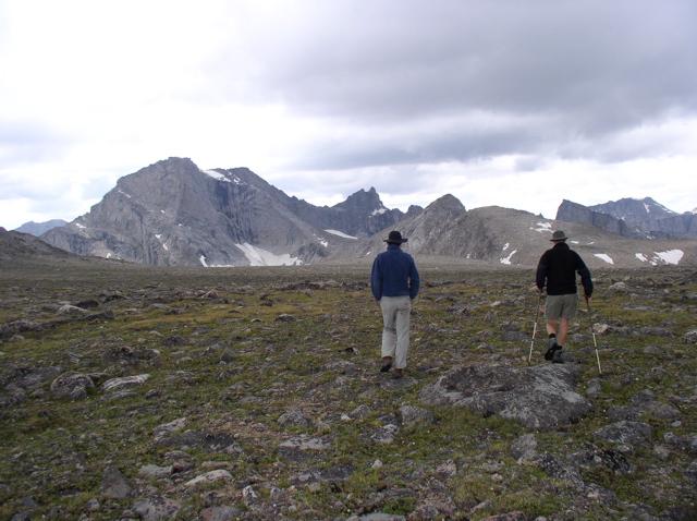
 Tom and Mike hiking along easy trail up toward Big Sandy Lake. |
Big Sandy Lake is quite large in relation to what I'm used to in Colorado and featured a great view of the Divide to the north and east. We set up camp in a well-used area near a metal bear bin and lounged about for a while having an early lunch. With camp established, we donned day-packs and headed out around the south side of the lake, across a large bog, and up the trail toward Black Joe Lake to the east.
The trail was definitely rougher, but still nothing exciting. We arrived at Black Joe Lake, a long, thin lake curving out of sight to the east between the steep granite bluffs of Haystack Mountain to the south and the scree and cliffs of the Divide to the north. The plan was to traverse the south shore of the lake and then explore the drainage above, possibly crossing over into the Little Sandy drainage to return.
 Big Sandy Lake looking north at the Divide (tk). |  Black Joe Lake looking east from a small cave. |
 Columbines and the 'trail' along the south shore of Black Joe Lake (tk) |  Charles and Mike resting after an arduous traverse (tk) |
This was a short-lived plan as we saw how difficult the going would become! After a hundred yards, the trail disolved to massive, sharp tallus shed from the cliffs above. Wildflowers cowered in the crevices and large spiders had spun webs across the gaps of many refrigerator and larger sized blocks. We tried traversing down by the lake or up higher in the slope with no obvious benefit to either route. At great length, we got to within sight of the other end of the lake. Continuing on wouldn't be easy, especially with no guaranteed non-technical way up and over the ridge into the next drainage. After a brief stop at a small snowfield, we turned around and clamborred out past columbine, lupine, fireweed, primrose, and more wildflowers just hitting their summer peak.
After dinner back at camp (also after a short, mild thunderstorm to the east), I ascended the rocky slabs of Schiestler Peak in the evening twilight communicating with the others via handheld radio. The going was steep but non-technical and I enjoyed a fantastic view of Big Sandy Lake and several smaller, subsidiary ponds laid out below me. To the north the bulk of Warbonnet Peak loomed over Jackass Pass, the gateway to the fabled Cirque of the Towers, tomorrow's destination. Didn't look so bad!

Big Sandy Lake as seen from a few hundred feet up the slabs of Shiestler Mountain. Warbonnet and Mitchell Peaks flank Jackass Pass in the center of the photo.
Monday, August 16 Mike awoke with a splitting headache today. We packed up camp and headed out, heavily laden, around the west side of the lake and started the climb up to Jackass Pass and the Cirque. Going was slow and Mike was not up to his usual torrid pace. The diagnosis was likely dehydration and altitude, but we had a short day planned (5 miles). The trail up from the lake was quite rough alternating between switchbacks through rubble reminiscent of yesterday's Black Joe Lake adventures and faint trail across rock slabs. No matter how hard the trail became, however, there were still, shall we say, signs of horse traffic. Horses must be more nimble and rugged than I give them credit for.
 The groggy morning scene at Camp II.(tk) |  Heading up some rocky terrain toward North Lake. |
 Nothing like some nice slab climbing with loaded packs! Mike and I regretting our decision to descend to North Lake quite so early. (tk) |
 Tom and I reach the first high-point on the way to Jackass Pass (mlf). |
The first challenge came a mile or two in when we dipped down to the shores of the small North Lake. The trail vanished ahead of us and we were presented with a 45-degree slab of smooth granite angling directly into fairly deep water. This would be no problem with proper rock shoes on and a slip would just land you in the water five feet below. However with hiking boots and 50-pound packs, it was entirely a different story. Tom and Mike scrambled across with some degree of floundering and made it dryly. At this point, several other hikers were perched 50' up the cliff laughing at (with?) us for having gotten off the trail. My boots proved better at technical edging and I scooted across fairly gracefully.
Lunch was had at the far side of the lake and we progressed upward once again. Mike's headache was better and our pace increased. After some serious altitude gain, we emerged into a flat alpine zone with tremendous views on all sides. The incredible east face of Warbonnet soared 2000' above Arrowhead Lake, a lake you don't notice until after passing it in the valley below. We decended a few hundred feet and started the final sandy climb to Jackass Pass and the Divide.
 Arrowhead Lake at the base of the stupendous Warbonnet face. |
 Mike and I reach the official crest of Jackass Pass (tk). |
 Tom and I and the view into the Cirque of the Towers (mlf). |
 This is what the place feels like (mlf) |
It's hard to properly appreciate the Cirque of the Towers, but Jackass Pass is a good place to try. The whole thing is a nearly complete ring of sheer vertical granite, ice, and improbably pointy towers about 2 miles in diameter. The large Lonesome Lake anchors the valley floor and numberous smaller lakes and streams flow from the melting snowfields down through jumbled granite boulders. The perfect circularity of the cirque is interupted by a protruding ridge from the west which terminates in the impressivly monolithic Pingora Peak which drops 1800' almost directly into the lake. It's like Yosemite but without all the tourists.
    Four photos which show the Cirque in all it's glory. From left to right we have Warbonnet, Warriors 1 and 2, Pylon Peak, Symmetry Block, Shark's Nose, Wolf's Head, Pingora, Skunk Knob and Lonesome Lake (tk). |
Feet screaming, we dropped down into the Cirque and rested under a large pine staring up at Pingora, the Wisconsin Couloir, and the other readily-identified features. The time was still fairly early (3pm?) and we leisurely set out to find a campsite. The highlands south-west of the lake proved fruitful and popular with many campsites, most of them occupied. Finally, we found a small level area on a tallus ridge 300' above the lake and probably a half mile distant. This is bar-none the most spectacular campsite I've ever stayed in and we were well-glad to be there. Water was fetched from a rubble-filled creek a hundred yards away and we set out for an evening hike.
 Our spectacular Camp III in the Cirque (tk). |
 Tom and the oft-photographed waterfall in the Cirque. |
 Tom and Mike explore the rocky Hidden Lake at the base of Warrior 2. |
From the campsite, we'd spied a lovely waterfall to the west tumbling over a broad bit of smooth granite. After achieving this destination, we made for the small Hidden Lake at 10,600' as the setting sun illuminated Warbonnet above and made everything even more gorgeous. Getting there was much harder than we'd anticipated however as the way was blocked with the biggest, baddest tallus we'd encountered so far. The lake, when we finally breached her defences, was gorgeous with light-blue glacial water dripping straight from the end of a snowfield between Warrior 1 and 2. We spent quite some time skipping stones before retreating back across the marsh and waterfall to the tent.
Mike had been dragging all day but when we got back to camp, we saw what looked like a bull moose down at Lonesome Lake. Mike was instantly energized, grabbing camera, headlamp and radio and instructing us to keep an eye on the moose while he tried to get a closer picture. He was off like a shot down the hillside and we tracked the moose through binoculars as he got closer and closer. Eventually he could be seen facing-off with the large ungulate at a distance of not more than 50'. The photos are spectacular!
 What we saw through binoculars... |
 ...and what Mike saw up close! |
 The setting sun paints Warbonnet with glorious light. |
 Mitchell Peak in the last of the day's light (mlf) |
 Tom and Mike at Lizard Head Meadows, officially leaving the Cirque. |
From here, we started climbing steeply up the Lizard Head Trail through forest and eventual alpine terrain. The trail is named for the main view, not the mountain up which it actually climbs; the trail ascends nearly 2000' in about 2 miles to the broad alpine plateau which is Windy Mountain. Along the way, the views of Lizard Head and the Bear Lakes to the east and the Meadow and Divide to the south are spectacular.

The impressive Lizard Head Peak with the Cirque of the Towers in the background. The Bear Lakes lie below (tk).
But the climb is very stiff! Mike and Tom had both recovered from whatever altitude-induced ailments they'd had on previous days and were leaving me huffing and puffing in the dust. It was with great relief that we finally topped out on the incredible alpine plateau and headed north on gentler terrain.

 A pair of interesting cairns on the way up the Lizard Head Trail. |
At 11,800', we paused for a break at a large cairn. The time was still pretty early and we had completed the hardest of the day's labors. To the east was a huge expanse of alpine tundra stretching to the ridge-line and unknown sights beyond. Leaving our packs at the cairn, we hiked across the flats examining alpine flowers and wandering over rocks and moss. When we finally reached the edge of the plateau at 12,000', the view was stunning! A steep snowfield dropped away below us to a chain of three lakes (Mendarrin, unnamed, and Cook Lake). It looked completely untrammeled and wonderful in every way... but a long way down away from our choosen direction of travel.
Back at the packs we continued northward. We were treated to expansive views of Lizard Head, Camel's Hump (including a large glacier hanging on it's northeast flank), and the many butresses of Payson Peak/Buffalo Head below. Three miles of hiking brought us up the surprisingly steep ridge of Cathedral Peak just as it started to rain. Distant thunder made us quicken our step and modify plans for a side-trip up Cathedral Peak.
 Hiking across the plateau at 12,000' (mlf) |
 Tom and I looking down toward Mendarrin Lake and others to the east (mlf). |
The weather worsened steadily as we dropped down the north side of Cathedral Peak into the broad pass with Mount Chauvenet. Tom and Mike elected to cut off a corner of trail and head directly down into the valley by the quickest route where the Bears Ear Trail could be seen. We'd proceeded a few hundred yards on steep tundra when suddenly the rain increased and the thunder appeared closer yet. We ditched our aluminum hiking poles and huddled near a rock, deploying a sheet of 0.3 mil plastic as a shelter. And not a moment too soon as the rain quickly turned into blinding hail and life became surprisingly unpleasent.
The lightning wasn't so bad, and we weren't in any real danger from it, certainly nothing compared to Amy and my experience on Pawnee Peak last month, but the hail was definitely interesting. After half an hour of huddling under the steamy, icy, flapping tarp, the hail abated and the storm moved on. We packed up and continued hurriedly down into the valley. Fortunately, the next rain didn't hit until we were down into the trees.
 Valentine Lake after the first of the rain storms. Clouds were lifting from Camel's Hump in the distance and it was absolutely gorgeous (though soggy) |
Valentine Lake hove into view remarkably quickly and we opted to set up camp a little earlier than we might otherwise have. We found a lovely spot under some trees above the lake. Traditional getting-into-camp lounging was cut-short by the arrival of the next batch of rain and we hurriedly set up the tent and found a dense thicket in which we could hang out without getting too wet. I set up the bear bag while Mike and Tom filtered water from the lake. Dinner of peanut noodles was consumed sitting on a small rock under a spreading pine tree which afforded some shelter from the rain.
After dinner, the rain abated pretty much all the way and we set out for a postprandial jaunt around the lake. Across the outlet was a rocky rise with a good view. We continued west through a recent forest fire zone of stripped, dead trees to a view to the west. In the evening twilighgt, Buffalo Head loomed above to the southwest and the steep-walled valley was impressive with bits of lifting fog still clinging to the cliff slopes. One of the smaller lakes in the Washakie drainage to the west could be seen with a tumbling fall of water coming out of it. Cirque of the Towers is a mind-blowing place, but honestly this was nearly as impressive and much wilder. The whole area had a very zen peacefulness and we wandered in silence through the half-light in unspoken camraderie.
 The scene outside the tent on Wednesday morning was grim indeed. The cameras went into deep storage shortly after this shot! (tk) |
Plans were quickly re-evaluated. Our options were to either spend the day in the tent and hope the weather would break later, hike on to Grave Lake anyway and spend at least one more night with likely sodden gear, or push out that day to the car. Sitting in the tent was unattractive and it looked like this weather system was here for keeps. Grave Lake is rumored to be lovely, but getting there would leave us with wet boots at the very least and an unappealing, restless night. Hiking out could be accomplished in 15-20 miles via a tough slog up the tall Washakie Pass (11,600') followed by a long, gradual descent west of the Divide back to the cars. As long as we were moving, we should remain warm. All of us have done this kind of marathon hiking before and it was well within our reach.
Packing up was accomplished hurriedly and we put delicate items such as sleeping bags and cameras into waterproof deep storage in the depths of our packs. Mike fashioned a poncho out of the 0.3 mil plastic tarp which was ill-fitting and floppy, but kept him drier than not (he was quickly dubbed the 'Ghost of Washakie Pass') and we set out at speed with a few crumbs in our bellies, a fire in our hearts, and a hunger for warm, dry bedding and hot food.
The first few miles down to Ranger Park were quick, soggy, and relatively high spirits. We reached the decision point between Grave Lake and Washakie Pass and unanimously choose the shorter, harder, more committing route. Uphill slopes took some of the steam out of our step and the going became difficult. The light, steady rain became somewhat heavier and the wind started to come up. At Washakie Lake, we passed half a dozen tents full of people who had choosen the more stationary option for today's activities (probably wise in retrospect).
The trail rose steeply from Washakie Lake and would undoubtedly have been spectacular and gorgeous under better circumstances. We passed out of tree line and into the brunt of the weather. The wind was strong out of the east (behind us, fortunately) and the rain was getting seriously cold. We arrived between two small lakes (Macon and Pass) and could see two passes through occasional breaks in the fog. The one on the right would require skirting Macon Lake but appeared lower and more gentle than the one straight ahead, covered in snowfields and steep rock. Not wanting to get out the map, we followed cairns up toward the latter, taller, snowier pass. Half way up we were trudging between rocks like zombies. The rain had turned to sleet and quickly to snow. Mike's ghost outfit/poncho had long-since shredded to nothing and we insisted that he stop on put on a fleece and a spare garbage bag over his cotton t-shirt (!). Tom and I noticed that our hands were dangerously cold and that we had very little manual dexterity left in them. This was getting serious!
But the pass was just overhead and turning back at this point (into the wind) would be probably harder and more dangerous than just bulling over the pass into the lee beyond. As long as nothing else happened to us (a twisted ankle, say) and we could keep moving, we'd be okay and survive this. Mike was starting to waver a bit and was having trouble finding the trail. I shouted encouragement to he and Tom and we traversed a small snowfield. The last hundred feet up to the pass were some of the hardest hiking I've ever done and it was with great relief that I collapsed down behind a small wind-screen at the summit of the pass...
...and immediately felt entirely too comfortable! Realizing I was in serious trouble if we stayed there, I got back on my feet rather unsteadily and urged Mike on. Tom had summitted at this point and was clearly in a similar state to me. Fortunately the pass was narrow and we quickly dropped down below the crest and the wind died down a bit. We were going to make it!
Another half mile of hiking brought us below the rain/snow line and out of the worst of the wind. I was mentally spent, but we still had to get down another mile or two into the trees before I'd breath completely easy again. Mike took off at this point like a shot down the easy trail and Tom and I followed behind. My feet were wet through and through and hurt like fury.
As we approached the trees, the weather became considerably better. Suddenly I spied a human form in a blue coat standing next to a pillar of smoke. Campfire! The others wheeled around at my cry and we thrashed through the bushes emerging at a roaring fire tended by three of the highest-quality humans available. We were surely an impressive sight to see and they offered us space by the fire and freshly-brewed coffee. None of us is a great coffee drinker, but I can safely say that none of us has ever tasted anything better in his entire life! Wow!
We chatted with our amiable hosts as we warmed and dried out by the fire. The were a father and son and friend from Laramie, all cabinetmakers by profession, up to do some hiking and fishing. They'd wondered about fishing the lakes on the other side of the pass but our tale convinced them to stay put for a little while. After a glorious half hour of warmth and camraderie, we pressed on with renewed vigor and shortly reached the Fremont Trail, our ticket out of the wilderness and back to the car. Finished! We were very pleased to see the car after 18.5 miles of wet hiking. |
The excitement was pretty much over at this point and we were left with eleven miles of grinding hike on easy trail back to the trailhead. My boots are great on technical scrambling, but become extremely painful after ten miles or so. The rain had mostly stopped by this point and we started to see people on the trails (including a pair of large pack goats). I was bonking hard, but Tom and Mike were still highly caffienated and extremely perky. We met a family of seven who were also headed out and chatted with them for much of the remaining distance. More accurately, Tom and Mike chatted while I put my head down and did my best to achieve purity of mind through pain of body. It must be harder than it sounds because I feel no more pure despite lots of pain.
We wearily hiked past Marm's Lake and Dad's Lake, through Fish Creek Park, and a long descent to the Big Sandy Trail half a mile from the campground. With a great sigh of relief, we reached the car at 6pm and I got to change out of my sodden, leaden footwear. We reached Rock Springs 2.5 hours later for a huge feast of Mexican food and then spend entirely too long finding the one remaining hotel room in Rock Springs. Showers and warm beds! Such luxuries!
It was a shame to have to pull out two days early but we accomplished quite a lot in those four days we did hike. The scenery was amazing and the terrain unlike anything I've seen before. In retrospect, the trip over the pass was definitely a bad idea and perhaps more dangerous than it seemed at the time. We survived and are wiser for the experience. Plus, what good is a hike without a little adversity and discomfort to make you appreciate life?
Many thanks to Mike and Tom who flew thousands of miles and spend hundreds of dollars to help me have one more wild adventure before settling down into the stable dullness (or so the stereotype goes) of married life.
 The Wilderness Journal |  Neithernor |