 Wilderness Journal: Maps!
These maps are for reference only. If you print them out and try to use them as substitutes for the real thing in the wilderness, you are a fool and don't deserve to be in the woods at all!
White Mountains
-
Scanned or digital Topo Maps
- Carter-Moriah Range Topo (USGS), Shelburne through Carter Notch. Courtesey of HTI and Photoshop.
- Mahoosic Range Topo (USGS), Shelburne to Grafton Notch. Courtesey of HTI and Photoshop.
- Pemmigewasset Wilderness Topo (USGS). Courtesey of HTI and Photoshop.
- Randolph Mountain Club Facilities, located on the north slopes of the Presidentials in NH. Also a useful reference for my Northern Presidentials hike. (USGS courtesy White Mountain Server)
- Mt. Adam, Mt. Madison and the Northern Presidentials everything from Appalachia south to Madison Hut. Also a useful reference for my Northern Presidentials hike. (USGS) (USGScourtesy White Mountain Server)
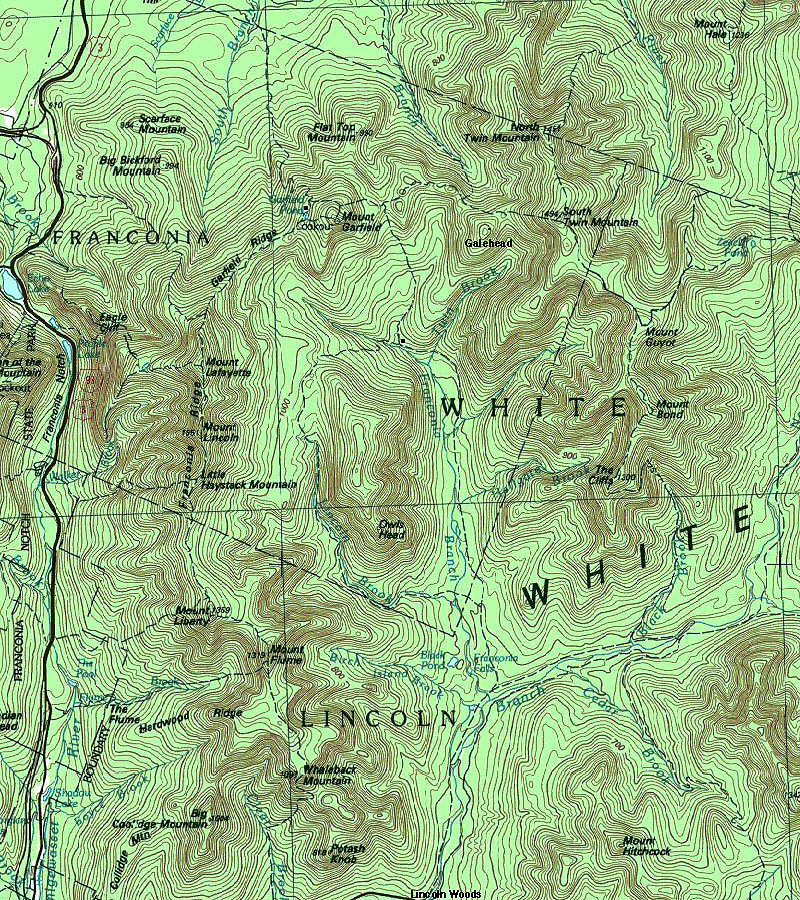
- Part of Franconia Notch and the Franconia Ridge featuring the route of a popular day hike in the area. (USGScourtesy White Mountain Server)
- Mt. Jefferson and its western approaches. (USGScourtesy White Mountain Server)
- Mt. Washington and its eastern approaches (USGS)
Other useful White Mountains Maps
- Northern Presidentials View with labels (local)
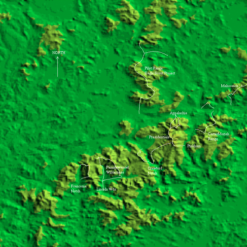
- White Mountains Relief Map with marked trails and locations. (generated with the Backcountry Home Page Map Generator and modified by me.)
- White Mountain National Forest area map. Includes roads and stuff. (USDAcourtesy White Mountain Server)
- Moosilauke Hiking Map some topo lines and a wealth of trail data. (Dartmouth Outing Guidecourtesy White Mountain Server)
- Trail Map of Franconia Notch (source?courtesy White Mountain Server)
- Relief Maps of US States
- Assategue Island Park Map (large)
- U. Texas National Park Map Collection (comprehensive)
- Harper's Ferry Hike, MapQuest with local modifications.
- Great Smokey Mountains NP scanned from a shaded relief map. At UTexas.
Map Sources Interactive Mapping sites
- Maps On Us! A very nice service with very detailed driving instructions. Only does US locations.
- Mapquest the whole world, at least at some level. Can be slow.
- Mapquest Topos, very nice!
- Yahoo! Maps much faster if you know the address. Only does US locations.
- ArcData OnlineFinally, a source of decent-quality online topographic maps!
- Terraserver, possibly the only good thing to come out of Micro$oft. Decent resolution B&W aerial and orbital photography. Good coverage of the US and parts of Europe.
- National Aerial Photography Program. Search for aerial and orbital images of the US. Somewhat squirrelly.
- Joshua Tree Landform Atlas Yes, it's at Talkcity which is annoying, but provides some topo landform images of JTNP in CA.
- OMNI Resources If the map exists, chances are OMNI will have it or can get it. Want geologic maps of obscure west aftrican countries in Russian?...
- USGS index map (USA)
- USGS Mapping department